How to study a GPS track before hitting the road
You’ve registered for the event, received the track, and now what? Now it’s your turn, time to study the route.
A well-made route is a mixture of challenge and comfort. While it’s exciting to see cyclists on Instagram pushing their bikes up a mountain ridge with a 25 percent incline in the dark, when it happens to you it’s not much fun. In the same way, having no idea where you can stop to eat or sleep can be epic seen in a post, but, again, not the best in reality.
That’s why we put all our experience into creating the routes for BAS events, so that you can have a great experience without the risk of crossing the line and deciding to hang up your bicycle forever.
On average, all people who cycle regularly at an amateur level can complete BAS events with ease; in fact, the “no race” approach of our events allows all participants to complete the route at their own pace, without rushing to cross the finish line.
BAS event routes are born out of exploration of the field, knowledge of professional topography, use of the best tracking tools and many many tests. All these elements allow us to design unique routes. This is not to say that it will be a piece of cake; there will be that mixture of fatigue and happiness that makes life’s experiences truly fulfilling.
To have the best experience, you have to do something yourself. That is, study the track.
Study a GPS Track for Bike Adventure Series Events: Complete Guide
Why Study a GPS Track?
- Possible errors in the track: better safe then sorry is the saying, and it applies here as well. It is always good to carefully check a track before setting off, even if the one you have on your hands was provided to you by the event hosts. It is always good to spot errors, if any, and report it so that you can avoid problems to other participants as well.
- Preparation and Safety: understanding the trail before the start allows you to plan stops and overnight stays, improving the overall experience and safety
- Efficient Navigation: Knowing the route avoids unnecessary detours and allows you to keep the focus on the adventure and the surrounding landscape.
- Energy Management: Knowing the trail, climbs and downhill, will help you better manage your energy during the event. And speaking of energy, if you are traveling by ebike identify any charging points along the route will come in very handy!
Let’s do it
Before anything else, try to answer these questions. How do you want to experience the event? Do you want to go fast? Do you want to see as much as possible? Do you want to stop and visit some particular place? Do you want to see how it goes day by day? These are all legitimate approaches; the first step is to figure out what you really want. Based on this, you can move on to the technical things that will then get you the experience you deserve.
Manage Climbs and Elevation
The real challenge is not in the distance of the stages but in the elevation gain you will have to face each day. In addition to the physical part you must in fact consider the mental attitude. Those who have done multi-day trips, or are used to doing very long rides, can tell you: if you are not focused, you will be in trouble.That’s also the beauty of cycling: it’s an ongoing cure for your brain and helps you connect body and mind. So, the climbs will definitely test you. Try to figure out during the year how many meters of elevation gain you can cover in a day. 1,000 meters? 2,000 meters? 3,000 meters? Only you can tell.
Consider Unexpected Events
To divide the route into stages, try assigning each stage an elevation gain that is suitable for your level, then take 300 meters off that number. Unexpected events (rain, puncture, etc.) do happen and they also give these adventures the right thrill, but they can make you late and this should be taken into account.
Study the Elevation Profile
Check the elevation profile to see where the highest climbing points will be and mark them mentally or directly on the map. When you are on the road, about 10 km before these points, eat and drink to be ready and don’t lose focus. Are there a series of short but back-to-back climbs? Keep a low pace and conserve your energy.
Plan the Daily Distance
Over to the distance, the method is the same. Is there a range of km per day you are comfortable with? Well, take away 15 km. Keep in mind that unlike other occasions, in Bike Adventure Series events you have all day to ride and basically all you have to do. Don’t overdo it though, especially if you’re not used to cycling multiple days in a row and remember that in multy-days trip, the beginning and end of the stages depend on one thing: where you will sleep. On this topic read our article Where to sleep on a bicycle trip.
In short, keep manageable stages, subtrack some and have fun!
Useful Tools for Studying a GPS Track.
Google Earth
Google Earth is a powerful tool for viewing GPS tracks in a realistic geographic context. Although the mileage and elevation data may not be very accurate, this tool gives you a broad understanding of what kind of route you are about to take. Using google earth to the fullest you can study the orography and be prepared in facing climbs and slopes, figure out which cities you will pass through, and thanks to street view you can get a first idea of the places you will visit and information about services in the area, such as hotels and restaurants.
Here’s how to use it:
- Import Track: After downloading the track in .gpx file, open Google Earth.
- Load File: Click on “File” > “Open” and select the downloaded .gpx file. The track will be displayed on the map.
- After displaying the data, save the file as KML.
- Exploring the Route: Use the zoom and rotation functions to explore the route, focusing on critical points such as steep climbs, slopes, and points of interest.
- Distance Measurement: Use the measuring tool to calculate distances between points, planning your stops.
Komoot
Komoot is a route planning and navigation platform ideal for cyclists. All you need to do is import the gpx within the app and you will receive valuable information such as the type of road surface you are going to ride on or the kind of climbs you will face.
Here’s how to use it:
- Import Track: Create an account on Komoot and access the “Plan a Tour” section. Upload the .gpx file.
- Track Analysis: Komoot will automatically analyze the track, providing detailed information on elevation, road surface patterns and points of interest.
- Modifications and Planning: You can add or edit waypoints to customize your route. Komoot will also suggest the best spots for stops and overnight stays based on recommendations from other users.
- Navigation: You can use the Komoot app to navigate in real time, receiving spoken directions and alerts on any detours.
Ride with GPS
Ride with GPS is an ideal platform for cyclists and bikepackers who want to plan and navigate their routes with precision and reliability. Once the .gpx file is imported, Ride with GPS provides a detailed view of the track, including elevation, distance, and ascent/descent information. This tool also helps identify critical points such as steep climbs or technical descents, allowing for strategic stop planning along the route. Additionally, the turn-by-turn navigation feature is available on both mobile devices and compatible cycling computers, ensuring a safe and deviation-free ride. Ride with GPS is especially useful for those looking to study routes in advance and maximize efficiency during events like the Bike Adventure Series.
Here’s how to use it:
- Create an account on Ride with GPS and log in.
- Import the .gpx file by clicking on “Upload” and selecting the file from your device.
- View the route details, including elevation profiles, distances, and key features such as climbs or descents.
- Customize the track by adding waypoints or adjusting sections of the route if needed.
- Sync with your GPS device or use the Ride with GPS mobile app for turn-by-turn navigation.
- Download the route for offline use to ensure you have access even in areas with limited cell coverage.
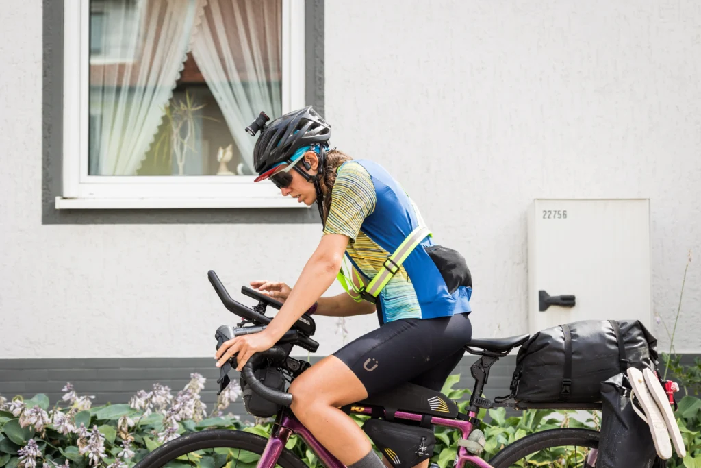
Cycling computers for navigation
Here we are talking about an electronic device with several functions that we can summarize as follows:
- Download GPS tracks and navigate in real time.
- Create routes
- Record activity and monitor performance.
Compared to the smartphone, the navigation experience of the cycling computer is significantly superior. The device provides more detailed information and keeps you from draining your phone battery, which is extremely valuable, especially during long trips and multi-day events.
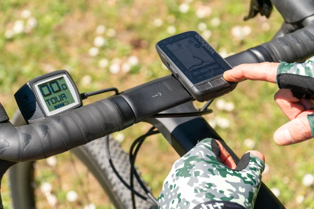
The most popular cyclocomputers used by cyclists are Garmin and Wahoo, so let’s see how to upload the gpx. track that you will be provided before the event to these devices.
Garmin: to import a gpx. track to Garmin download the Garmin Connect app on your smartphone and follow these steps:
- Open the Garmin Connect app on your smartphone.
- Go to “Workouts ‘ and select ’Routes ”.
- Press the “+” button to create a new route or import one.
- Select “Import GPX file ”.
- Choose the GPX file from your device.
- Save the route and sync it to your Garmin device via the app.
Once synced you will find the track among your saved routes and all you have to do is start pedaling.
Wahoo: to import a gpx track to Wahoo download the ELEMNT app and then follow these steps
- Open the Wahoo ELEMNT app on your smartphone.
- Go to the “Routes ” section.
- Tap “Import file ” and select the GPX file from your phone.
- Once imported, synchronize the route with your Wahoo cyclocomputer.
The route will now be available for navigation on your Wahoo device.
Conclusion
Studying a GPS track is essential to make the best of the bikepacking experience offered by the Bike Adventure Series events. Using tools such as Google Earth and Komoot, and following the tips provided, you will be ready to ride with confidence and enjoy every mile of your trip. Remember, preparation is the key to an unforgettable adventure.
For more information on BAS events and GPS tracks, visit the official Bike Adventure Series website and download detailed guides for each event.
Have a great ride!

Add comment